Mapping the Urban Farming Activites Data Visualization and Mapping Poster by Longfeng WU |
Home > Winners > #42401 |
 |
|
||||
| DESIGN DETAILS | |||||
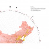
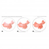
| DESIGN NAME: Mapping the Urban Farming Activites PRIMARY FUNCTION: Data Visualization and Mapping Poster INSPIRATION: The project not only replies on traditional source of data like official statistical data and open source map, but utilize the pc-Internet news to extract and construct an original data set. By combining the statistic and news reports, a map describes the happening of farming in urban area at a national scale co-related with the aging population and urban sprawl from 1990 to 2010. It encourages to rethink how researcher can gain data when the critical one is publicly unavailable. UNIQUE PROPERTIES / PROJECT DESCRIPTION: The project tries to reveal the time-spatial dynamics of urban farming by old people associated with the urban construction, aging population and farmland occupation during the rapid urban sprawl period in China. Cities in China mostly occupy the agricultural land and turn the peasants to urban citizens overnight. But, most farmers especially the older generations hardly adopt the urban life instantly. The news about old people planting vegetables in the public green spaces of city are common. OPERATION / FLOW / INTERACTION: 1, The aging population map in 2010 and China's urban expansion map during 1990 to 2010 form the base map processed in the Arcgis 10. 2, The location(city) and net citizens' comments of the urban farming activities by old population is extracted by a customized script from Baidu.com. 3, The news data is geo-referenced on the base map in Arcgis and further rendered in by vectorwork and Adobe Illustrator. PROJECT DURATION AND LOCATION: The project is presented at the Esri Developer Summit in Palm Springs (March 2015), and the Esri International User Conference in San Diego, CA (summer 2015). It was also collected by CGA center website at Harvard University. FITS BEST INTO CATEGORY: Graphics, Illustration and Visual Communication Design |
PRODUCTION / REALIZATION TECHNOLOGY: Technology: The map is drawn and rendered by vector graphic applications such as Adobe Illustrator and Vectorworks. News about the old people farming in the cities are extracted by a customized java scripts. Material/Source of Data: National maps, urban expansion and population statistic data are from published materials. News(more than 200 reports from 2000 to 2010) about the old people farming in the cities are extracted based on Baidu News(the largest Chinese Internet news site). Reference 1, news.baidu.com 2, Harvard Geographic Library 3, Historical China County Population Census Data with GIS Maps 4, China’s urban expansion from 1990 to 2010 determined with satellite remote sensing, Wang 2012. 5, http://worldmap.harv SPECIFICATIONS / TECHNICAL PROPERTIES: 915mm*1066mm TAGS: Data Visualization, Mapping, Poster, Urban Farming, On-line News, Urban Expansion, Aging Population, China's Cities RESEARCH ABSTRACT: The project tends to spatially depict a social phenomenon during the rapid urban construction period of China started in the late 1980s. Cities in China mostly occupy the agricultural land and turn the peasants to urban citizens overnight. However, most farmers especially the older generations who had been working and living on the rural land hardly accept the urban life instantly. The news about old people planting vegetables in the public green spaces of city are common. The project tries to reveal the time-spatial dynamics of urban farming by older people associated with the urban construction, aging population and farmland occupation. The project will not only reply on traditional source of data such as official statistical data, open source map and satellite image etc., but utilize the pc-Internet news to extract and construct an original data set. By combining the statistic and news reports, a heat map describes the happening of farming in urban land at a national scale co-related with the aging population and urban construction from 1990 to 2010. The approach of data extracting in the project will inspire to use the online resources by largely relying on the search engine. It also encourage to rethink how researchers can gain data in the country where most critical data are kept away from public. CHALLENGE: The ultimate goal of the project is on one hand to document the undocumented common phenomenon at a national level to inform the public of on-going urbanization in China. Moreover, it is an experimental attempt to use the on-line fragmented resources based on the search engine to build an original data source that could be open to the public. It could also be a possible approach to explore the more popular data source recently-the use of mobile Internet. ADDED DATE: 2015-08-24 13:12:56 TEAM MEMBERS (1) : Designer: Longfeng WU IMAGE CREDITS: Longfeng WU, 2015. PATENTS/COPYRIGHTS: Copyrights belong to Longfeng WU,2015. |
||||
| Visit the following page to learn more: http://www.gis.harvard.edu/resources/awa |
|||||
| AWARD DETAILS | |
 |
Mapping The Urban Farming Activites Data Visualization and Mapping Poster by Longfeng Wu is Winner in Graphics, Illustration and Visual Communication Design Category, 2015 - 2016.· Read the interview with designer Longfeng WU for design Mapping the Urban Farming Activites here.· Press Members: Login or Register to request an exclusive interview with Longfeng WU. · Click here to register inorder to view the profile and other works by Longfeng WU. |
| SOCIAL |
| + Add to Likes / Favorites | Send to My Email | Comment | Testimonials | View Press-Release | Press Kit |
Did you like Longfeng Wu's Graphic Design?
You will most likely enjoy other award winning graphic design as well.
Click here to view more Award Winning Graphic Design.

